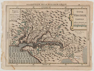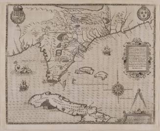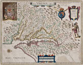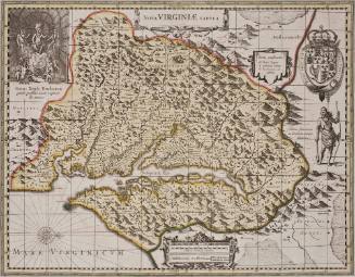
Virginiae Partis australis et Floridae partis
Date1671
Compiler
Arnoldus Montanus (ca. 1625-1683)
Engraver
Jacob van Meurs
After work by
Jodocus Hondius II
1594 - 1629
MediumLine engraving on laid paper with hand coloring
DimensionsOverall: 12 1/16 × 14 3/16in. (30.6 × 36cm)
Credit LineGift of Elise H. Wright
Object number2024-188
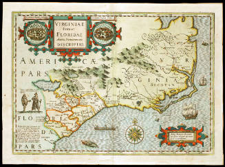
DescriptionMap: Virginiae Partis australis et Floridae partis, Jacob van Meurs, MontanusLabel TextThis highly decorative map is a derivative of a 1606 map of the southeast by Dutch mapmaker Jocodus Hondius Sr. In 1606, Hondius updated of Gerard Mercator's map of the southeastern coast of North America in order to include newly discovered information about Virginia. This representation of the region persisted well into the eighteenth-century. This copy, by Arnoldus Montanus, published 65 years later indicates how persistent and important the idea of the Hondius map was. Montanus embellished the map with generic depictions of Native Americans, which by then were well-recognized symbols of the New World.ProvenanceBefore 2024, Elise Wright (Richmond, VA); 2024-present, given to the Colonial Williamsburg Foundation (Williamsburg, VA)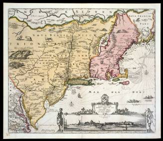
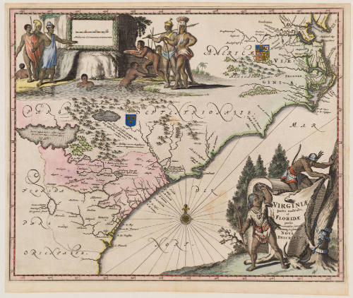
Nicolas Visscher (1618-1679)
ca. 1684; originally published ca. 1655
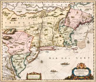
Nicolas Visscher (1618-1679)
1657
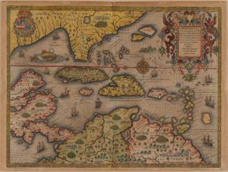
Jodocus Hondius I
First published 1606; This example: 1634