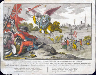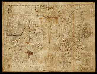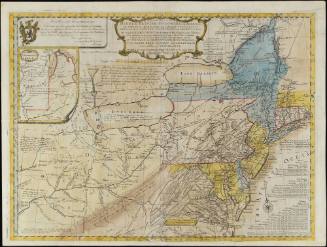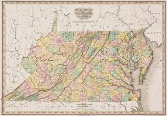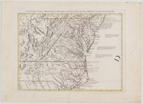
Il Maryland, Il Jersey Meridionale, La Delaware, La Parte Orientale Della Virginiae Carolina Settentrionale
Date1778
Maker
Antonio Zatta
1757 - 1797
OriginEurope, Italy, Venice
MediumLine engraving on laid paper with hand coloring
DimensionsOverall: 16 1/4 × 22 3/16in. (41.3 × 56.4cm)
Credit LineGift of Elise H. Wright
Object number2024-189
DescriptionMap: Il Maryland, Il Jersey Meridionale, La Delaware, La Parte Orientale Della Virginiae Carolina Settentrionale, Antonio ZattaLabel TextThis map created by cartographer Antonio Zatta is an Italian copy of the Mitchell Map, one of the most influential maps of America in the 18th century that laid cartographic claims to the Ohio Valley prior to the French and Indian War. This later copy of the Mitchell demonstrates the map's continued use over generations. The map was issued as part of Zatta's Atlante Novissimo and is one of twelve sections making up the Italian edition of Mitchell's map of North America. Zatta's map covers the Atlantic coast from Philadelphia to Cape Lookout and extends west to the Ohio River. The map also indicates the locations of indigenous tribes, such as the Tuscaroras and Catawbas in North Carolina. The map shows the Granville line at 35.5 degrees latitude.ProvenanceBefore 2024, Elise Wright (Richmond, VA); 2024-present, given to the Colonial Williamsburg Foundation (Williamsburg, VA)

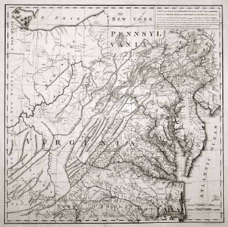
Jean Baptiste Poirson (1760-1831)
1799
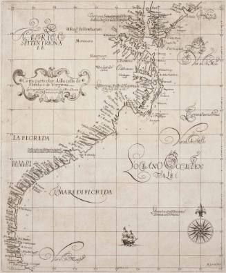
Sir Robert Dudley (1574-1649)
1647