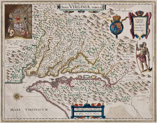
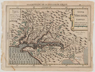
NOVA VIRGINIAE TABULA
Date1662
Publisher
Willem Janszoon Blaeu
1571 - 1638
After work by
Captain John Smith
1580 - 1631
MediumBlack and white line engraving with period color
DimensionsOverall: OH: 21" x OW: 24 1/2"; To neat lines: 14 3/4" x 18 3/4"
Credit LineMuseum Purchase
Object number2017-41
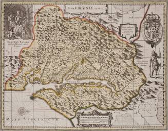
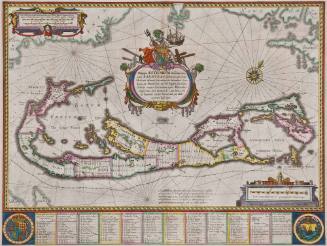
DescriptionThe upper cartouche reads: "NOVA VIRGINIAE TABULA"As in the case of the Smith map, this version carries in the upper left the scene in Powhatan's lodge, labeled as follows: "STATUS REGIS POWHATAN/ quando prefectus Smith Captivus/ illi daretur"
In the upper right is a plaque bearing the inscription: "Notarum/ explicatio/ Domus regum/ Ordinariae Domus/ Lucubrationes anglo/rum"
The lower cartouche reads: "Miliaria Germanica communia 15 pro Uno gradu/ Ex officina Guiljelmi Blaeuw./ DGrijp/ Sculpt."Label TextThis is the first derivative, state 2 of 1612 map of Virginia (see acc. no. 2017-197). The plate for this first derivative of Smith's map was originally created by Jocodus Hondius Jr. in 1618 but was purchased and altered by Willem Janszoon Bleau after his death in 1629. Blaeu altered the imprint of the map. The map was included in "Atlas Maior," 1662. This map appeared in Blaeu atlases over many editions and years, with no changes.
This copy is published in William C. Wooldridge, "Mapping Virginia: From the Age of Exploration to the Civil War" (Charlottesville: University of Virginia Press, 2012), pp. 39-40, #30.ProvenanceBefore 1999, Jo Ann and Richard Casten (Old Field, NY); 1999, purchased by William C. Wooldridge (Norfolk, VA); 2009, purchased by the Virginia Cartographical Society (Norfolk, VA); 2017-present, purchased by the Colonial Williamsburg Foundation (Williamsburg, VA).
Willem Janszoon Blaeu
1630