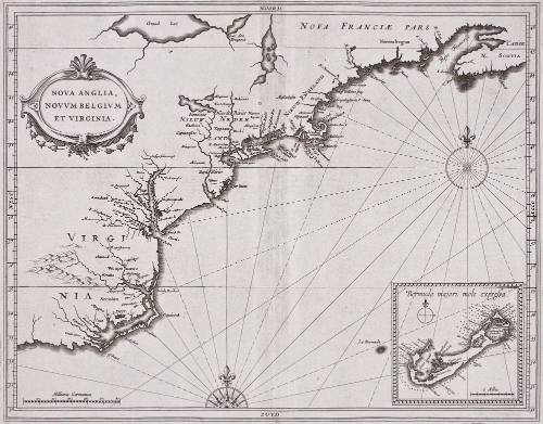
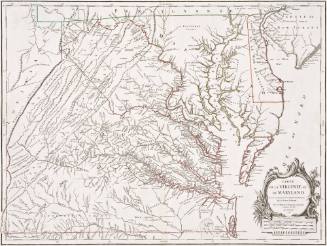
Nova Anglia,Novum Belgium Et Virginia
Date1630
Compiler
Joannes de Laet
1583 - 1649
Engraver
Hessel Gerritsz
1581 - 1632
MediumBlack and white line engraving
DimensionsOverall: OH: 13 5/8" x OW: 15 3/4"; To neat lines: 11 1/8" x 14 1/8"
Credit LineMuseum Purchase
Object number2017-60
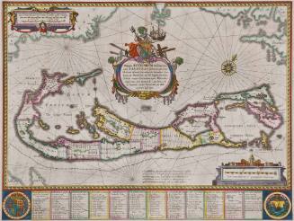
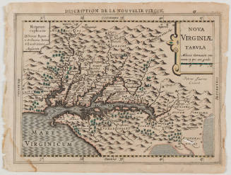
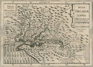
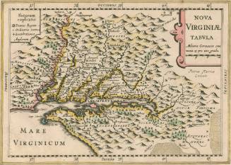
DescriptionCartouche reads: "NOVA ANGLIA,/ NOVVM BELGIVM/ ET VIRGINIA"Lower right reads: "Bermuda majori mole expressa"Label TextThis map was in-part created using data compiled by the Dutch West India company of which it's maker Johannes De Laet was one of the founder and director. It was the first to use the names Manhattan, N. Amsterdam (New York) and Massachusetts. Additionally, it was the earliest to identify the Hudson and Delaware Rivers as the names Noordt Rivier and Zuyd Rivier, respectively.
This copy published in William C. Wooldridge, "Mapping Virginia: From the Age of Exploration to the Civil War" (Charlottesville: University of Virginia Press, 2012), #49, pp. 56-58.ProvenanceBefore 1996, Martayan Lan Augustyn (New York, NY); 1996, by William C. Wooldridge (Norfolk, VA); 2009, purchased by the Virginia Cartographical Society (Norfolk, VA); 2017-present, purchased by the Colonial Williamsburg Foundation (Williamsburg, VA).
Jodocus Hondius I
First published 1606; This example: 1634
Willem Janszoon Blaeu
1630
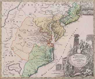
Johann Baptist Homann (1663-1724)
ca. 1714