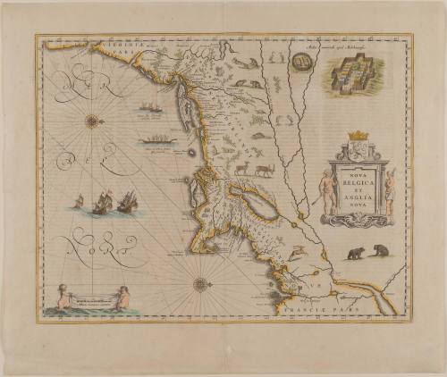
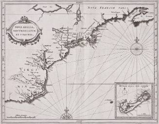
NOVA BELGICA ET ANGLIA NOVA
Date1635
Cartographer
Willem Janszoon Blaeu
1571 - 1638
Publisher
Willem Janszoon Blaeu
1571 - 1638
Publisher
Joan Blaeu
1596 - 1673
MediumLine engraving on laid paper with hand coloring
DimensionsOverall: 15 1/4 × 19 3/4in. (38.7 × 50.2cm)
Framed: 23 × 26 3/8 × 7/8in.
Framed: 23 × 26 3/8 × 7/8in.
Credit LineMuseum Purchase
Object number1968-128
DescriptionThe right center cartouche reads: " NOVA/ BELGICA/ ET/ ANGLIA/ NOVA"Label TextAn effective complement to the Smith map that focuses on the coastline and waterways, this map by William Blaeu supplies more detail on the terrain. Blaeu's intent was to supply the East India Company with maps of the region because of its interest in the New England fur trade. The profits realized from this trade served as a primary catalyst for map production in the northern colonies.Like many of the early maps illustrating North America, the orientation is with north to the right.ProvenanceBefore 1968, the Old Print Shop (New York, NY); 1968-present, purchased by the Colonial Williamsburg Foundation (Williamsburg, VA).
Willem Janszoon Blaeu
1630
Jodocus Hondius I
First published 1606; This example: 1634
Robert Sayer (1725-1794) & John Bennett (fl. 1760-1787)
1776