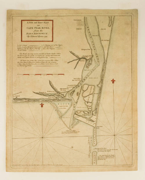
A New and Exact PLAN of CAPE FEAR RIVER, from the BAR to BRUNSWICK,
Date1768
Cartographer
Edward Hyrne
ca. 1694 - 1755
Publisher
Robert Sayer
1725 - 1794
Publisher
Thomas Jefferys
1719 - 1771
OriginEngland, London
MediumBlack and white line engraving with period hand color on laid paper
DimensionsOH: 16 5/8" x OW: 13 5/8"; Plate H: 15 5/8" x W: 12 7/8"
Credit LineMuseum Purchase
Object number2009-105
DescriptionA chart of the Cape Fear River from the Bar to Brunswick. Appeared in Thomas Jefferys' "A General Topography of North America and the West Indies," 1768.The upper left cartouche reads: "A New and Exact PLAN/ of/ CAPE FEAR RIVER,/ from the/ BAR to BRUNSWICK,/ By Edward Hyrne 1749."
The lower margin reads: "Printed for Rob.t Sayer in Fleet Street and Tho.s Jefferys the Corner of S.t Martins Lane in the Strand."ProvenanceBefore 2009, Cohen & Taliaferro LLC (New York, NY); 2009-present, purchased by the Colonial Williamsburg Foundation (Williamsburg, VA).
Bernard Ratzer
January 12, 1776
Robert Sayer (1725-1794) & John Bennett (fl. 1760-1787)
July 17, 1776
Robert Sayer (1725-1794) & John Bennett (fl. 1760-1787)
1776