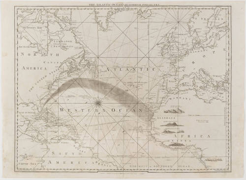
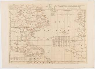
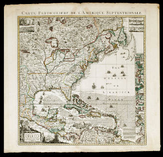
THE ATLANTIC OCEAN/ By GOVERNOR POWNALL F.R.S.
DateSeptember 20, 1787
Cartographer
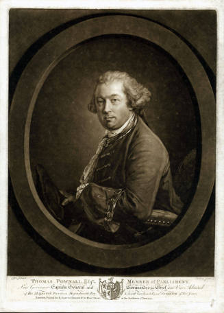
Governor Thomas Pownall (bapt. 1722-1805)
Publisher
Robert Sayer (1725-1794)
OriginEngland, London
MediumLine engraving on laid paper
DimensionsOH: 20 5/8" x OW: 28 1/8"; Plate H: 20" x W: 25 3/4"
Credit LineMuseum Purchase
Object number2002-49
DescriptionThe upper margin reads: "THE ATLANTIC OCEAN/ By GOVERNOR POWNALL F.R.S."The lower margin reads: "Published 20.th Sept.r 1787, by Rob.t Sayer, 53 Fleet Street, London."Label TextThis map depicts the path of the Gulf Stream from the tip of Florida to the coast of Africa. Benjamin Franklin commissioned a chart of the Gulf Stream from George LeRouge, a French mapmaker, between 1780-1783. This is one of the first maps published to depict the stream. Pownall was a close friend of Franklin, and Franklin supplied the information on this map.ProvenanceBefore 2002, Jonathan Potter Limited (London, England); 2002-present, purchased by the Colonial Williamsburg Foundation (Williamsburg, VA).
Robert Sayer (1725-1794) & John Bennett (fl. 1760-1787)
1776


Charles Willson Peale (1741-1827)
1787