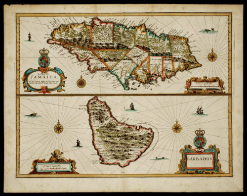
A MAP OF/ JAMAICA/ BARBADOS
Date1676
Cartographer
John Speed (1552-1629)
Publisher
Thomas Bassett
fl. 1659 - 1693
Publisher
Richard Chiswell
1639 - 1711
OriginEngland, London
MediumBlack and white line engraving with period hand color on laid paper
DimensionsOH: 17 1/4" x OW: 21 7/8"; Plate H: 15 1/4" x W: 20"
Credit LineMuseum Purchase
Object number1968-141,A
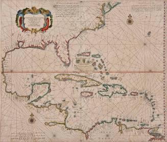
DescriptionThese two maps on a single sheet depict Jamaica and Barbados.JAMAICA:
The cartouche reads: "A MAP OF/ JAMAICA/ Sold by Thomas Basset in Fleet Street, and/ Richard Cheiswell in S.t Pauls Church yard."
The scale reads: "A Scale of English Miles"
BARBADOS:
The cartouch reads: "BARBADOS"
The scale reads: "A Scale of English Miles"
ProvenanceBefore 1968, the Old Print Shop (New York, NY); 1968-present, purchased by the Colonial Williamsburg Foundation (Williamsburg, VA).
Phillip Lea (fl. 1666-1700, d. 1700)
ca. 1698
Jean-Baptiste Bourguignon d'Anville (1697-1782)
June 10, 1775
Robert Sayer (1725-1794) & John Bennett (fl. 1760-1787)
July 17, 1776
Bishop James Madison (1749-1812)
1807
John Lodge (fl. 1754-1796)
1781
William Faden (1750-1836)
November 26, 1781