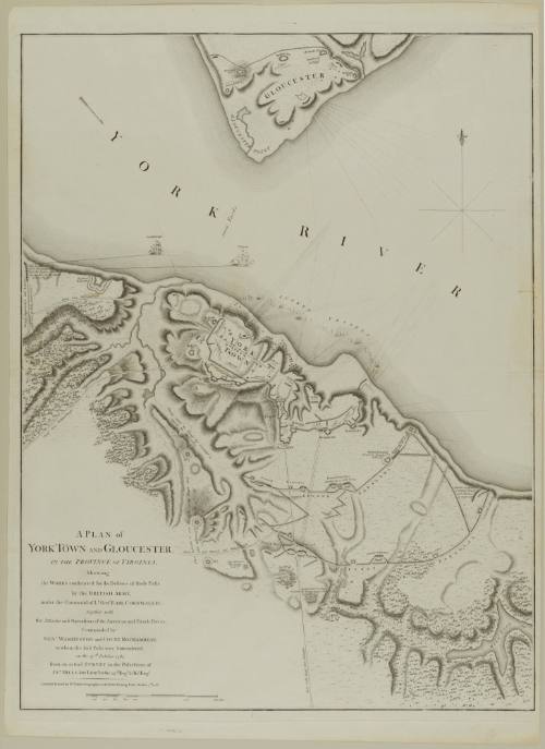
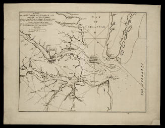
A PLAN of YORK TOWN AND GLOUCESTER, IN THE PROVINCE OF VIRGINIA, Shewing the WORKS constructed for the Defence of those Posts by the BRITISH ARMY, under the Command of Lt. Genl. EARL CORNWALLIS;
Date1785
Cartographer
Lieutenant John Hills (fl. 1777-1817)
Publisher
William Faden (1750-1836)
OriginEngland, London
MediumLine engraving on laid paper
DimensionsOverall: 28 1/2 × 21 1/2 in (72.39 × 54.61cm)
Credit LineMuseum Purchase
Object number1975-9
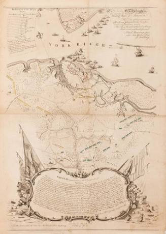
DescriptionText in the lower left corner reads: "A PLAN of/ YORK TOWN AND GLOUCESTER,/ IN THE PROVINCE OF VIRGINIA,/ Shewing/ the WORKS constructed for the Defence of those Posts/ by the BRITISH ARMY,/ under the Command of Lt. Genl. EARL CORNWALLIS;/ together with/ the Attacks and Operations of the American and French Forces,/ Commanded by/ GEN.L WASHINGTON and COUNT ROCHAMBEAU,/ to whom the said Posts were Surrendered/ on the 17.th October 1781./ from an actual SURVEY in the Possession of/ JN.O HILLS, late Lieut.t in the 23.d Reg.t & Ass.t Eng.r/ LONDON: Printed for W.M FADEN, Geographer to the KING, Charing Cross, October 7.th 1785."Label TextPublished three years after the adjacent map by Edward Fage, this work closely corresponds to the version of the battle presented in the earlier map. The only major difference is the absence of the line of sunken vessels of f the shore of Gloucester Point, illustrated in Fage's map.This plan of Yorktown and Gloucester was published in William Faden's 1793 "Atlas of Battles of the American Revolution."ProvenanceBefore 1975, Kenneth Nehenzahl Inc. (Chicago, IL); 1975-present, purchased by the Colonial Williamsburg Foundation (Williamsburg, VA).

Joseph Frederick Wallet Des Barres
1782


William Faden (1750-1836)
November 26, 1781