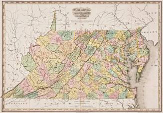
A Map of the State OF VIRGINIA REDUCED from the NINE SHEET MAP of the STATE, in conformity to Law: by Herman Böÿe
Date1827
Compiler
Herman Boye
Engraver
Henry Schenck Tanner
1786 - 1858
Engraver
E.B. Dawson
Commissioned by
Commonwealth of Virginia
MediumLine engraving on laid paper with hand coloring, mounted on linen with silk
DimensionsOverall: 30 × 48 in (76.2 × 121.92cm)
Credit LineMuseum Purchase, The Friends of Colonial Williamsburg Collections Fund
Object number2026-96
DescriptionThe cartouche reads, "A/ Map of the State/ Of/ VIRGINIA/ REDUCED/ from the NINE SHEET MAP of the STATE in con/ formity to Law by Herman Boye/ Engraved by H.S. Tanner and E.B. Dawson."The lower left margin reads, "Entered according to Act of Congress, the 31st day of October 1827 by W.B. Giles, Governor of the State of Virginia."Label TextThis is a reduced-scale copy of the first map of Virginia funded by the Commonwealth of Virginia. In 1816, realizing the need for a new and complete survey of the state, the Virginia legislature passed an act to create a map of the state.
John Wood was appointed to supervise the project intially, overseeing the completion of surveys for 96 of Virginia's then 102 counties. After his death in 1822, died in 1822, having completed maps of 96 of Virginia’s then 102 counties. The task of completing the map fell to Danish surveyor Herman Böÿe to compete the project and compile the map. Though dated 1826, 400 copies of the nine-sheet map were printed in Philadelphia was distributed in early 1827. Later that year, the Virginia legislature commissioned a reduced, four-sheet version of the map (this copy) which was published in Richmond and engraved and printed in Philadelphia by Tanner and Dawson.
These maps became outdated necessitating the General Assembly to commission the Board of Public Works in 1849 to commence work on revising the original work of Wood and Böÿe. It took ten years to include all of the changes that the state had undergone since the 1820s including 42 new counties.To cut costs, the state required that the original copperplates used for the 1826/27 nine-sheet map were updated. Finally, in 1859, the revised version of the nine-sheet map, known as the Böÿe-Buchholtz map (2017-167) was published. A four-sheet reduced copy followed. Both maps served an important role for both sides during the Civil War.
ProvenanceDates unknown, probably descended in the Preston family (Montgomery County, Virginia); dates unknown, likely given to Gabriel Colvin Wharton [1824-1906] (Radford, VA); 1906-2009, likely given to a private collector; 2009, Private Collection [sold, Quinn & Farmer Auctions, Charlottesville, VA, July 27, 2009, Lot 119]; 2009-2026, purchased by a "distinguished private collector in the mid-Atlantic region"; 2026, [Michael Buehler, Boston Rare Maps, Southampton, MA]; 2026-present, purchased by the Colonial Williamsburg Foundation (Williamsburg, VA).