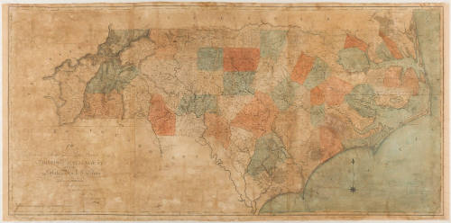
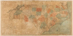
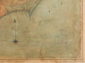
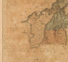
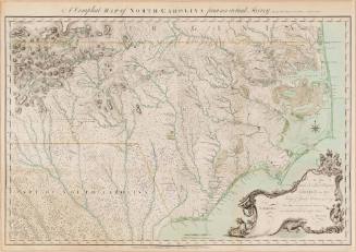
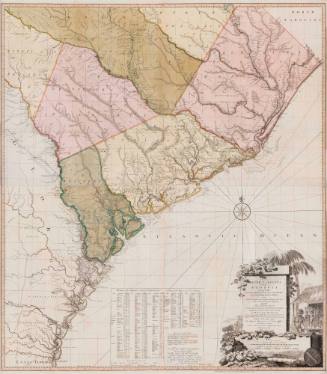
First Actual Survey of the State of North Carolina
Date1808
MediumLine engraving on laid paper with hand coloring
DimensionsFramed dimensions: OH: 31 ½" OW: 60 ½"
Credit LineMuseum Purchase
Object number2012-148
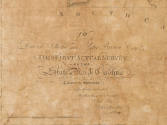
DescriptionThe lower left corner reads, "To/ David Stone and Peter Brown Esq.rs/ This First Actual Survey/ of the/ State of North Carolina/ Taken by the Subscribers/ is respectfully dedicated/ By their humble servants/ Jon.a Price/ John Strother./ 1808/ Engraved by W. Harrison Philad.a./ Printed by C.P. Harrison."Label TextThis map was the first map of North Carolina based on data taken from actual surveys and was the most accurate map of the state. In the 1790s, the North Carolina state government passed "A Bill for Obtaining an Accurate Map of the State," following the petitions of Jonathan Price and Nathaniel Christmas. The General Assembly funded the surveying project with £5 per county survey (58 counties total), for a total of £290. With the average operating costs of county surveys nearing closer to £35, the surveyors sought subscribers and asked leading local citizens to support the project. Nathaniel Christmas left the project and was replaced by John Strother, a surveyor from Culpepper County, Virginia. Price and Strother collaborated on coastal surveys but divided the county surveying between them. Either Jonathan Price or William Christmas compiled the county surveys to create a comprehensive, large map of the state. The map was engraved in Philadelphia, which was the center of American map engraving during the Early Republic period. William Harrison, the engraver, used three copperplates to reproduce the large wall map. During a time of westward expansion, booming populations, and a need to update the cartographic record after the American Revolution, the Price-Strother map was a pioneer in the movement to create updated, comprehensive, American-made state maps based on actual surveys.ProvenanceProbably 1808, probably purchased by Aaron Lindley [1768-1853] (Chatham County, NC); 1853, to his wife Phoebe MacPherson Lindley [c. 1766-c. 1864] (Chatham County, NC); 1864, to her son Owen Lindley [1806-1887] (Chatham County, NC); 1887, to his wife Basha Elliott Lindley [1826-1897] (Chatham County, NC); 1897, to her son Daniel Webster Lindley [1868-1956] (Guilford County, NC); 1956, to his wife Nancy A. Henley Lindley [1871-1964] (Guilford County, NC); probably 1964, probably to her son Charles F. Linley [1917-1989] (Guilford County, NC) ; 1989, to his wife Elizabeth Lyne Montague Nunnally Lindley [1947-2010] (Guilford County, NC) ; 2010, to her daughter Gay Montague (Grigg) Phillips [1947-2011] (Newport News, VA); 2012,Toddsbury Sale, Estate of Gay Montague (Grigg) Phillips [sold, Sallie Moore Auctions, Mathews, VA, July 21, 2012]; 2012-2012, purchased by Mark R. Wenger; 2012-present, purchased by the Colonial Williamsburg Foundation (Williamsburg, VA).
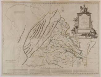
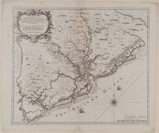
Bishop James Madison (1749-1812)
1807
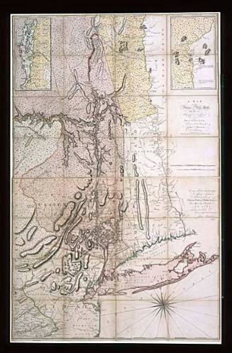
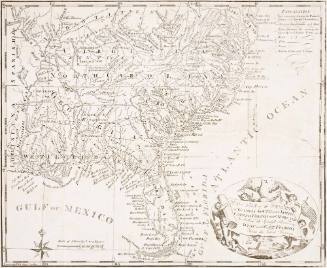
Captain John Montresor (1736-1799)
June 10, 1775

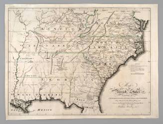
Alexander Wilson
1809 (although dated October 1. 1808)