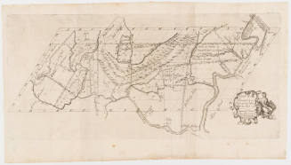
Map No. I
Date1747
Cartographer
Lewis Evans
ca. 1700-1756
Cartographer
James Alexander
1691 - 1756
Engraver
James Turner
1722 - 1759
Publisher
James Turner
1722 - 1759
MediumLine engraving on laid paper
DimensionsFramed: 23 1/2 × 20 × 7/8 in
Overall: 15 3/4 × 12 5/8 in (40.01 × 32.07cm)
Overall: 15 3/4 × 12 5/8 in (40.01 × 32.07cm)
Credit LinePurchased with funds from Anna Glen Vietor in memory of her husband, Alexander O. Vietor.
Object number1992-29
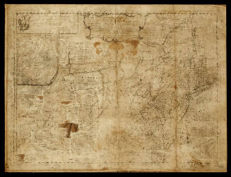
DescriptionThe center right cartouche reads: "MAP N.o I/ NOTE THAT/ What are called/ by the following/ Names in this Map/ Were in the/ Dutch time/ Called/ Hudson's River Noordt Rivier/ Delaware River Zuydt Rivier/ New York/ Nieuw Amsterdam/ ALBANY Fort Orangie/ New Castle Fort Casimir/ Note also that/ These Names/ in this Map/ Are commonly Called/ Bridlington Burlington/ Burnigat Barnagat/ Little Egg Little Egg Harbour."Below is a key indicating how the maps were to be colored.
The text below the cartouche reads: "Engraved & Printed by James Turner near the Town House BOSTON"
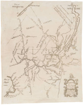
Label TextThis map, along with Map No. II (2019-88) and Map No. III (2019-87) was inserted in the 1747 book "A Bill in the Chancery of New-Jersey at the Suit of John of Stair..." The book sought to prove that the Board of Proprietors of the Eastern Division of New Jersey held land rights in Elizabeth Town (today Elizabeth), New Jersey over yeomen inhabitants. James Alexander, a Scottish-born lawyer and politician, led the effort to create a bill that would enforce the payment of quit-rents and subsequent evictions. After the proprietors began evictions, land claimants rioted and accused the proprietors of greed. Alexander proposed the bill's publication to defend against these accusations of greed. Three maps would clarify convoluted land claims and impose a proprietary vision of land possession. Upon Benjamin Franklin's advice that "the maps cannot be had in this country done otherwise by hand," Alexander decided the maps could only be produced by hand and commissioned Lewis Evans, a Philadelphia-based surveyor and geographer, to hand draw the three maps. Soon, however, New York printer James Parker secured a deal to reduce the cost of paper. Now, two hundred and fifty engraved maps, instead of forty hand-drawn ones, could be produced at a similar price point. Alexander hired James Turner, a Boston engraver and silversmith, to engrave the map copperplates.
Map No. I portrayed New Netherlands and different Dutch, English, and Swedish outposts of the late seventeenth century. With boundaries borrowed from Henry Popple’s 1733 Map of the British Empire in America, Evans added a key with colors, along with notes about Dutch counterparts of place names. The map’s focus on European forts and settlements erased Munsee, Lenape, Haudenosaunee, and other Indigenous nations, disregarding their centrality to the region.ProvenanceBefore 1992, W. Graham Arader III (New York, NY); 1992-present, purchased with funds from Anna Glen Vietor in memory of her husband, Alexander O. Vietor by the Colonial Williamsburg Foundation (Williamsburg, VA)
Associated Object/Associated Object