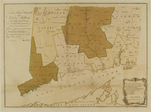
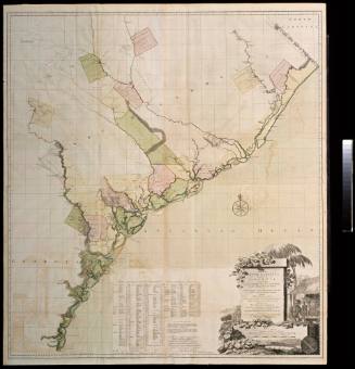
To the Right Honourable/THE/ Earl of Shelburne/ His MAJESTY'S Principal/ SECRETARY of STATE/ for the Southern Department/ This PLAN of the COLONY of CONNECTICUT in/ NORTH-AMERICA...
Date1766
Cartographer
Moses Park
MediumLine engraving on laid paper with hand color
DimensionsOverall: 24 × 29 3/4in. (61 × 75.6cm)
Framed: 30 5/8 × 38 1/8 × 7/8in.
Framed: 30 5/8 × 38 1/8 × 7/8in.
Credit LinePartially funded by members of the Raleigh Tavern Society: Mr. Joseph R. Lasser, Dr. Lee P. Haacker, Mr. Glenn Sandison, Mr. & Mrs. Irving F. Jensen, Jr.
Object number1997-40
DescriptionThe text in the upper left corner reads: "To the Right Honourable/THE/ Earl of Shelburne/ His MAJESTY'S Principal/ SECRETARY of STATE/ for the Southern Department/ This PLAN of the COLONY of CONNECTICUT in/ NORTH-AMERICA/ Is Humbly Dedicated by his Lordship's/ Most Obedient Humble/ Serv.t/ Moses Park./ Nov.r 24.1766."ProvenanceBefore 1997, Henry Taliaferro (New York, NY); 1997-present, purchased by the Colonial Williamsburg Foundation (Williamsburg, VA).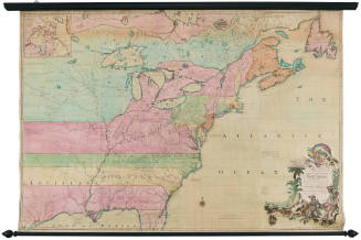
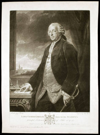
John Boydell
November 1, 1780

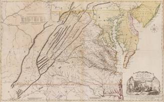
Joshua Fry (ca. 1700-1754) & Peter Jefferson (1708-1757)
1768; first published ca. 1753
1690-1710
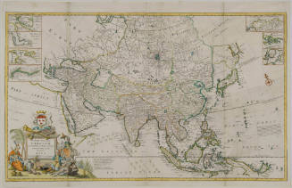
1702 (dated)

1750-1800
ca. 1765