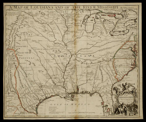
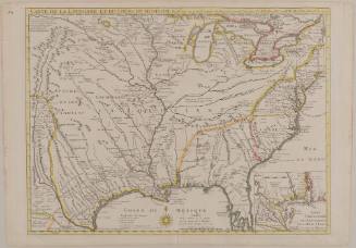
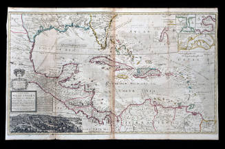
A MAP OF LOUISIANA AND OF THE RIVER MISSISSIPI
Date1721
Cartographer
John Senex (1678-1740)
After work by
Guillaume de L'Isle (1675-1726)
Publisher
John Senex (1678-1740)
OriginEngland, London
MediumLine engraving with period hand color on laid paper
DimensionsOH: 19 7/8" x OW: 23 1/2"; Plate H: 19 3/8" x W: 22 7/8"
Credit LineMuseum Purchase
Object number1968-134
DescriptionThe upper margin reads: "A MAP OF LOUISIANA AND OF THE RIVER MISSISSIPI By John Senex"The lower right cartouche reads: "THIS MAP/ of the/ MISSISSIPI/ Is Most humbly Inscribed/ to William Law of Lawreston Esq."Label TextThis map appeared in John Senex's "A New General Atlas," 1721.ProvenanceBefore 1968, the Old Print Shop (New York, NY); 1968-present, purchased by the Colonial Williamsburg Foundation (Williamsburg, VA).
Guillaume de L'Isle (1675-1726)
June 1718
Herman Moll (1654?-1732)
1740-1745 (originally published 1715)
Robert Sayer (1725-1794) & John Bennett (fl. 1760-1787)
1776
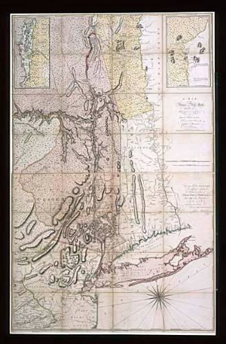
Captain John Montresor (1736-1799)
June 10, 1775