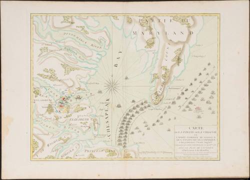

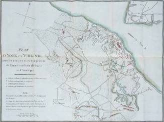
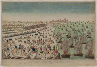
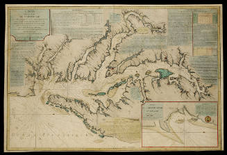
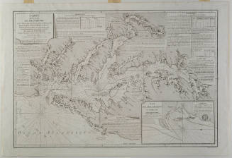
CARTE DE LA PARTIE DE LA VIRGINIE ou L'ARMÉE COMBINÉE DE FRANCE & DES ÉTATS-UNIS DE L'AMÉRIQUE
Date1782
Maker
Esnauts & Rapilly (fl. ca. 1775-1811)
OriginEurope, France, Paris
MediumLine engraving on laid paper with hand coloring
DimensionsOverall: 22 × 30 1/2in. (55.9 × 77.5cm)
Credit LineGift of Mr. and Mrs. Richard F. Barry, III, Mr. and Mrs. Macon F. Brock, Mr. and Mrs. David R. Goode, Mr. and Mrs. Conrad M. Hall, Mr. and Mrs. Thomas G. Johnson, Jr., Mr. and Mrs. Charles W. Moorman, IV, and Mr. and Mrs. Richard D. Roberts.
Object number2017-241
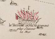
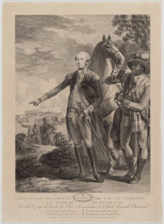
DescriptionThe lower right cartouche reads: "CARTE/ DE LA PARTIE DE LA VIRGINIE/ ou/ L'ARMÉE COMBINÉE DE FRANCE &/ DES ÉTATS-UNIS DE L'AMÉRIQUE/ a fait prisonniere l'Armée Anglaise/ commandée par LORD CORNWALLIS le 19 Oct.bre 1781./ AVEC LE PLAN DE L'ATTAQUE/ d'York-town & de Glocester./ Levée et dessinée sur les Lieux par Ordre des Officiers Gen.x/ de l'Armée Française & Américaine./ A PARIS, Ches Esnauts et Rapilly, rue S.t Jacques a la Ville de Coutances."Label TextOn August 14, 1781, General Washington received news that would shape his strategy for the remainder of the Revolutionary War. In order to support the American campaign, French Admiral François Joseph Paul, Comte de Grasse, had left the West Indies with a fleet of twenty-eight ships of the line, six frigates, and three thousand troops bound for the Chesapeake Bay. De Grasse arrived in the Chesapeake on August 26. When the British navy under the command of Admiral Thomas Graves appeared at the Virginia Capes on September 5, de Grasse dispatched his warships to the mouth of the bay. Although the ensuing battled lasted less than three hours, the British fleet was heavily damaged. Six of Graves' nineteen ships were temporarily taken out of action. The Terrible, illustrated in flames, was so mutilated that the British eventually had to destroy the vessel.
This map depicts a dramatic, somewhat stylized version of the important role the French allies played in the American victory at Yorktown. Designed for the French market, it illustrates - and perhaps enhances - their position at the mouth of the Chesapeake Bay. It was obvious to the French people that Cornwallis could neither flee or receive reinforcements.Provenance2005 (Paulus Swaen, Clearwater, FL, December 2005, Lot 21169); 2005, purchased by William C. Wooldridge (Norfolk, VA); 2009, purchased by the Virginia Cartographical Society (Norfolk, VA); 2017-present, given to the Colonial Williamsburg Foundation (Williamsburg, VA).
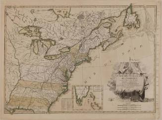
Michel Capitaine du Chesnoy (1746-1804)
after 1779
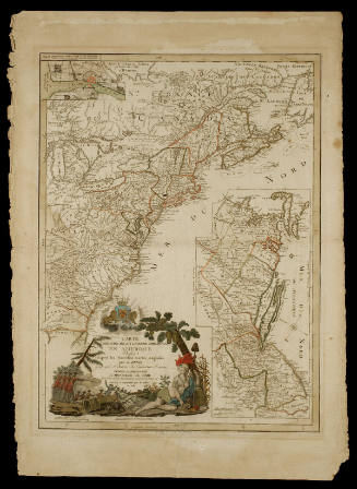
Jean Lattré (fl. 1743-1793)
1784
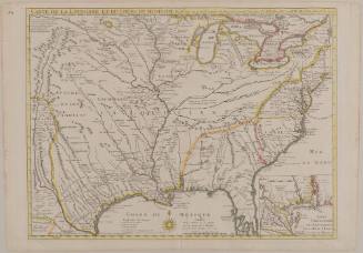
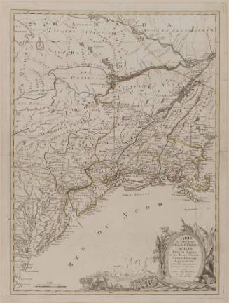
Guillaume de L'Isle (1675-1726)
June 1718