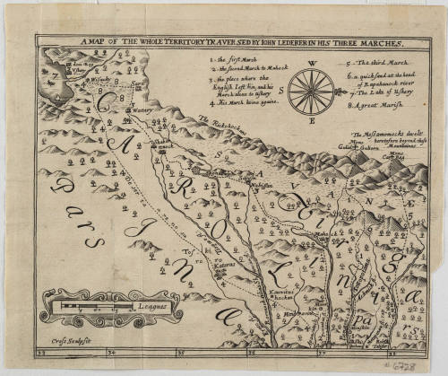
A Map of the Whole Territory Traversed by John Lederer in His Three Marches
Date1672
Cartographer
John Lederer
Retailed by
Samuel Heyrick
Engraver
Thomas Cross
1632 - 1682
Secondary Maker
William Talbot
1658/9-1730
OriginEngland, London
MediumLine engraving on laid paper
DimensionsOverall: 7 3/4 × 9in. (19.7 × 22.9cm)
Credit LineGift of Mr. and Mrs. Richard F. Barry, III, Mr. and Mrs. Macon F. Brock, Mr. and Mrs. David R. Goode, Mr. and Mrs. Conrad M. Hall, Mr. and Mrs. Thomas G. Johnson, Jr., Mr. and Mrs. Charles W. Moorman, IV, and Mr. and Mrs. Richard D. Roberts.
Object number2017-219
DescriptionTitle along the upper margin: A MAP OF THE WHO TERRITORY TRAVERSED BY IOHN LEDERER IN HIS THREE MARCHES."Signed in lower lower left corner, "Cross sculpsit."
The text around the compass rose reads, "1. the first March/ 2. the second March to Mahock/ 3. the place where the/ Engligh left him, and his/ March along to ushery/ 4. His March home againe./ 5. The third March. 6. a quick sand at the head of Rapahanock river/ 7. The Lake of Ushery/ 8. A great Marish."Label TextThe map includes the up-to-date, although largely incorrect, discoveries made by John Lederer, the first European to explore and record information about the Piedmont and the Appalachian Mountains. Lederer made three expeditions through southwest Virginia and Carolina in 1669-1670 attempting to locate a route through the Appalachian Mountains to facilitate trade with the Indians.ProvenanceBefore 2003, Richard B. Arkway (New York, NY); 2003, purchased by William C. Wooldridge (Norfolk, VA); 2009, purchased by the Virginia Cartographical Society (Norfolk, VA); 2017-present, given to the Colonial Williamsburg Foundation (Williamsburg, VA).
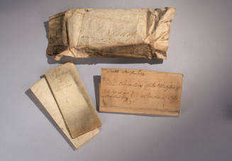

Elizabeth Champion
1830-1840, with earlier textiles