
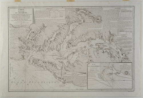
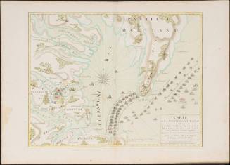
CARTE DE LA BAIE DE CHESAPEAKE
Date1778
Compiler
Antoine de Sartine
1729 - 1801
After work by
Anthony Smith
Engraver
Petit (fl. 1775-1799)
Commissioned by
Antoine de Sartine
1729 - 1801
Publisher
Departement de la Marine
OriginEurope, France, Paris
MediumLine engraving on laid paper
DimensionsOverall: 26 × 38 1/2 in (66.04 × 97.79cm)
Credit LineGift of Mr. and Mrs. Richard F. Barry, III, Mr. and Mrs. Macon F. Brock, Mr. and Mrs. David R. Goode, Mr. and Mrs. Conrad M. Hall, Mr. and Mrs. Thomas G. Johnson, Jr., Mr. and Mrs. Charles W. Moorman, IV, and Mr. and Mrs. Richard D. Roberts.
Object number2017-236
DescriptionThe cartouche in the upper left corner reads: "CARTE/ DE LA BAIE/ DE CHESAPEAKE/ et de la Partie navigable des Rivieres, James, York, Patowmack,/ Patuxen, Patapsco, North-East, Choptank et Pokomack./ REDIGEE POUR LE SERVICE DES VAISSEAUX DU ROI,/ au Depto General des Cartes, Plans et Journaux de la Marine,/ Par Ordre de M. DE SARTINE,/ Conseiller d'Etat, Ministre et Secretaire d'Etat au Departement de la Marine,/ d'apres des Plans Anglois./ et particulierement ceux d'Antione Smith, Pilote de S.ta Marie,/ 1778./ N.B. Les Brasses indiquees sont en Mesure/ d'Angleterre. La Brasse Angloiseest/ egale a 5 Pieds 7 p. 61 2/3 Mesure de France./ Les Divisions de L'Echelle de Latitude/ donnent les Milles Marins et servent/ d'Echelle pour le Plan."The upper left corner of the Herring Bay map reads: "PLAN/ DE LA BAIE HERRING/ EN MARYLAND/ Echelle de deux Lieues Marines/ N.B. Les Chiffres iniquant les profondeurs de l'Eau en Pieds/ Anglois de 11 Pouces 3 lig 1/9 de celui de France."
The lower margin reads: "Petit Sculp"
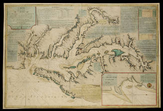
A detailed chart of the waters of Chesapekae Bay plus the navigable rivers flowing into the Bay. The observations are noted inset on the next page.Label TextThis map depicts the Chesapeake Bay as well as the navigable rivers flowing into the Bay. Observations and instructions are noted on the map. In the lower right corner is an inset map of Herring Bay in Maryland. This map appeared in the French NEPTUNE of 1770-1780 under Depot des Cartes et Plans de la Marine.
This copy is published in William C. Wooldridge, “Mapping Virginia: From the Age of Exploration to the Civil War” (Charlottesville: University of Virginia Press, 2012), #146, pp. 155-156.ProvenanceBefore 1996, Quincy G. Williams (Philadelphia, PA); 1996, purchased by William C. Wooldridge (Norfolk, VA); 2009, purchased by the Virginia Cartographical Society (Norfolk, VA); 2017-present, given to the Colonial Williamsburg Foundation (Williamsburg, VA).
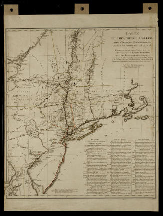
Michel Capitaine du Chesnoy (1746-1804)
after 1779



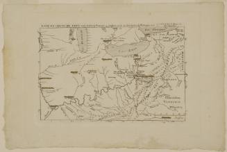
Joshua Fry (ca. 1700-1754) & Peter Jefferson (1708-1757)
1756

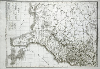
Jean Baptiste Poirson (1760-1831)
1799
Esnauts & Rapilly (fl. ca. 1775-1811)
1782